
**Advanced Bridge Inspection Drone Solution with High-Resolution Multi-Sensor Payload & Powerful Spotlight Illumination**
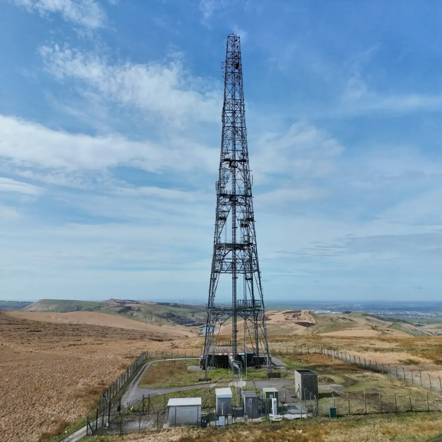
Elevate your bridge assessments with our state-of-the-art enterprise drone platform, our primary tool for precise infrastructure inspections. This compact, rugged system delivers unmatched safety, speed, precision, and data quality when examining decks, piers, abutments, cables, girders, and other critical components — even in low-light or shadowed areas.
**Core Challenges of Traditional Bridge Inspections**
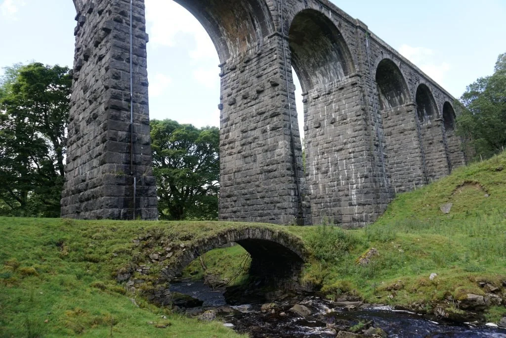
Conventional methods rely on personnel climbing structures, scaffolding, or aerial work platforms — exposing teams to significant safety risks, especially in adverse weather, high winds, or confined spaces. These approaches cause lengthy traffic disruptions, require substantial manpower and equipment, drive up costs, and often result in incomplete coverage of hard-to-reach zones. Manual data collection is time-consuming, prone to human error, and difficult to compare over time for trend detection.
**Our Drone-Led Advantage**
We deploy a highly capable, weather-resistant drone equipped with advanced imaging, thermal sensing, precise ranging, intelligent lighting, and **RTK centimeter-level precision** to eliminate these pain points:
- **Zero-Risk Personnel Safety** — Inspect elevated, confined, or underside areas from the ground. No climbing, no baskets, no exposure to heights or harsh conditions.
- **Rapid, Comprehensive Coverage** — Automated waypoint missions or precise manual control scan large bridges quickly, ensuring full coverage without gaps and minimizing — or eliminating — road closures and traffic interruptions.
- **Significant Cost Savings** — Replace expensive specialized equipment and large crews with an efficient, user-friendly drone solution. Increase inspection frequency affordably while reducing overall project expenses.
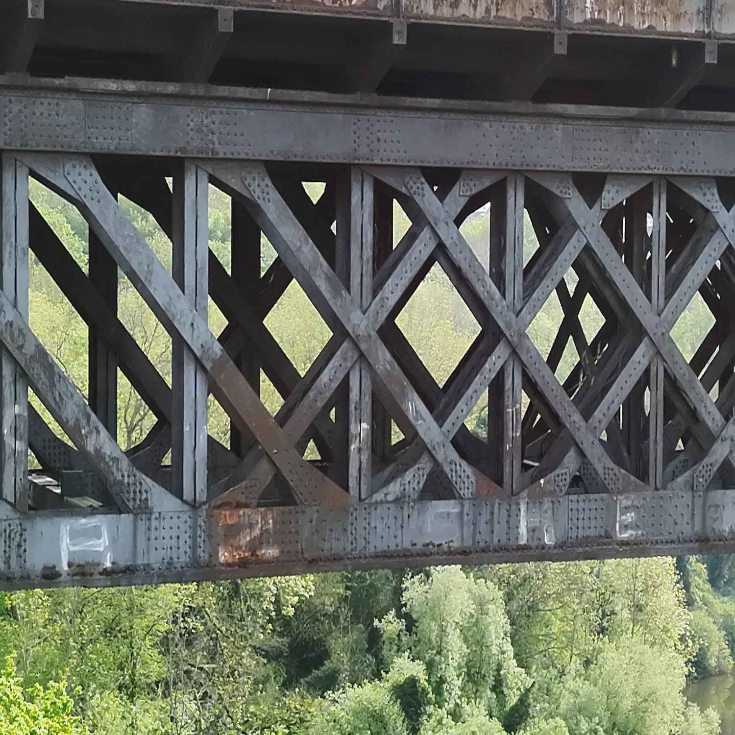
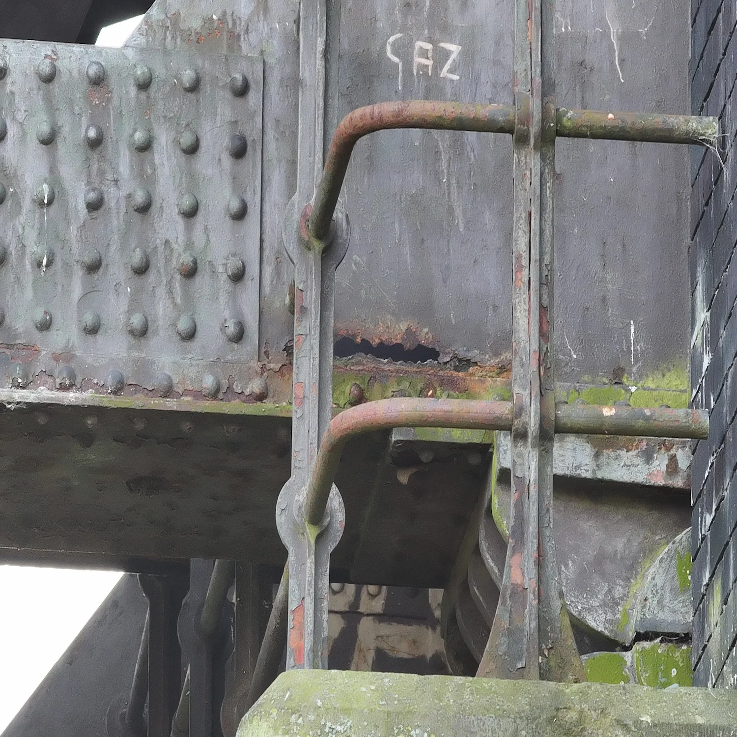
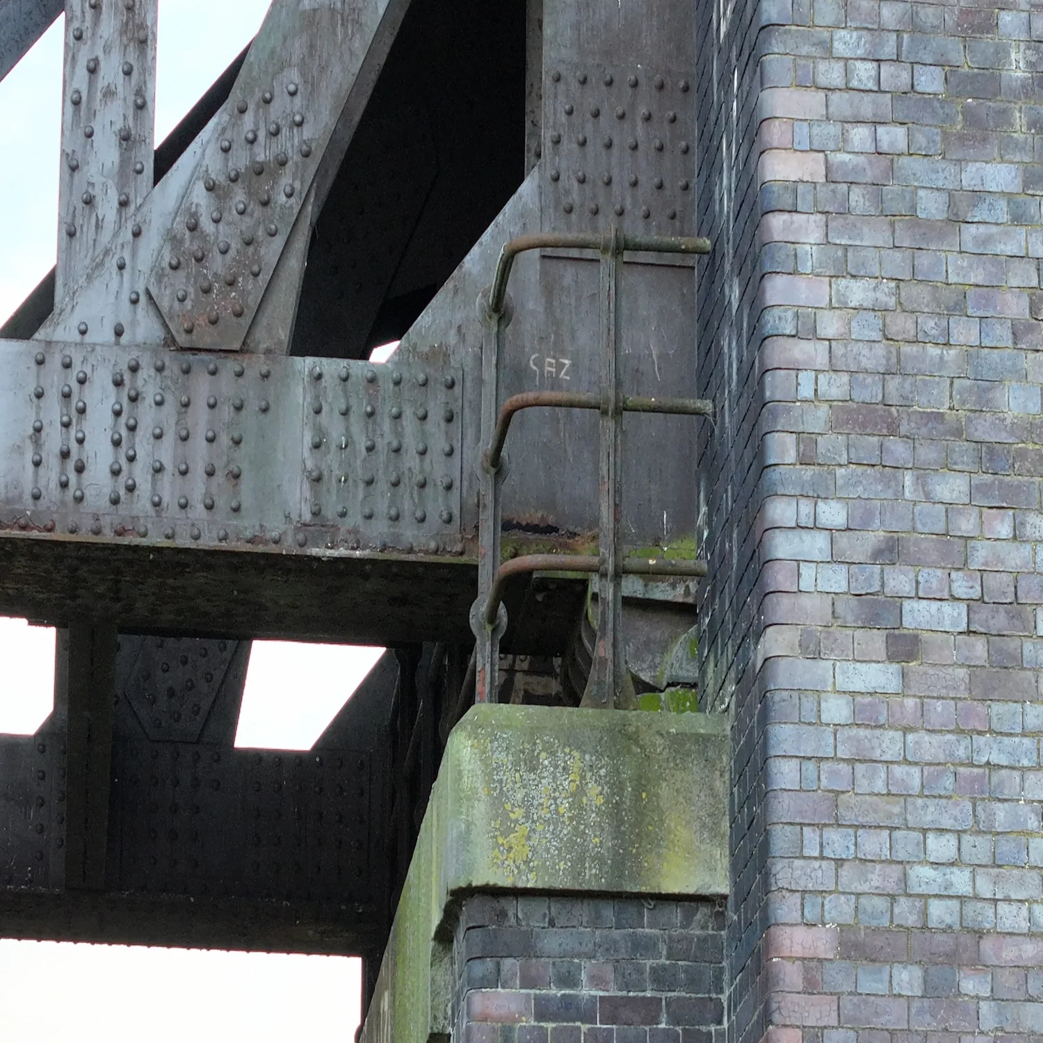
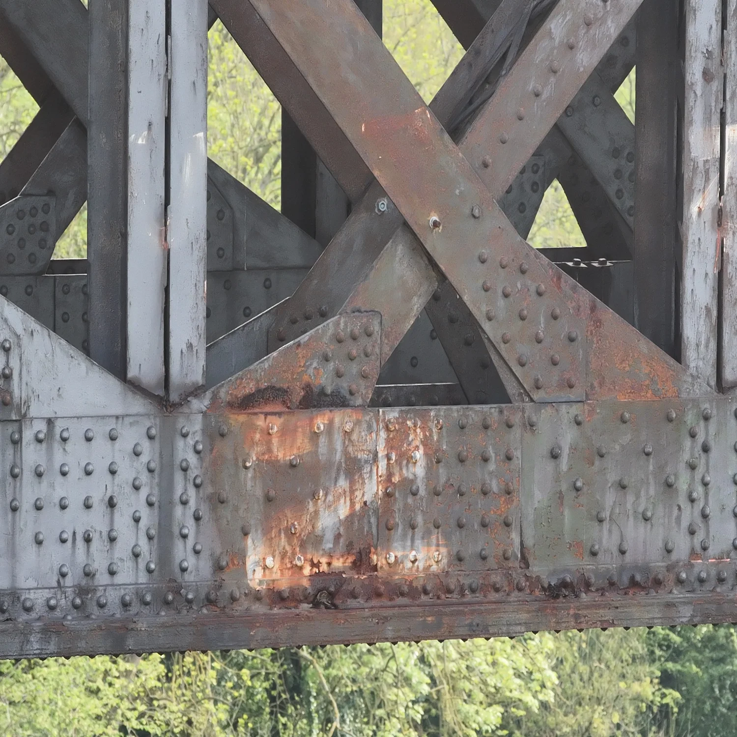
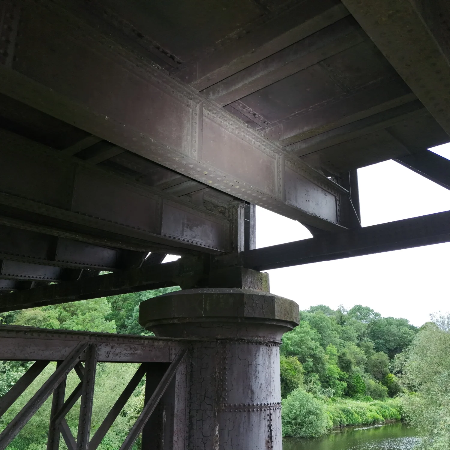
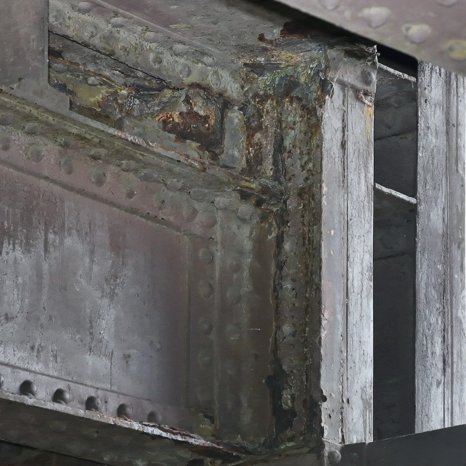
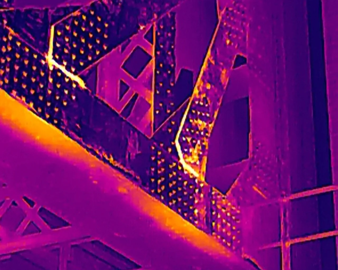
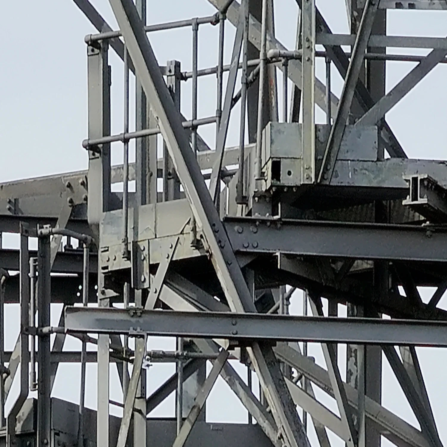
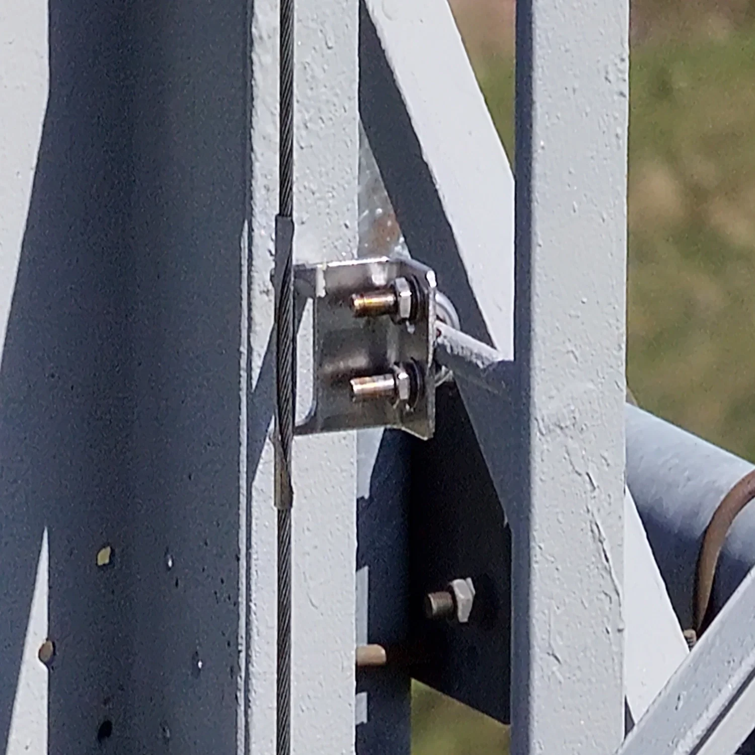
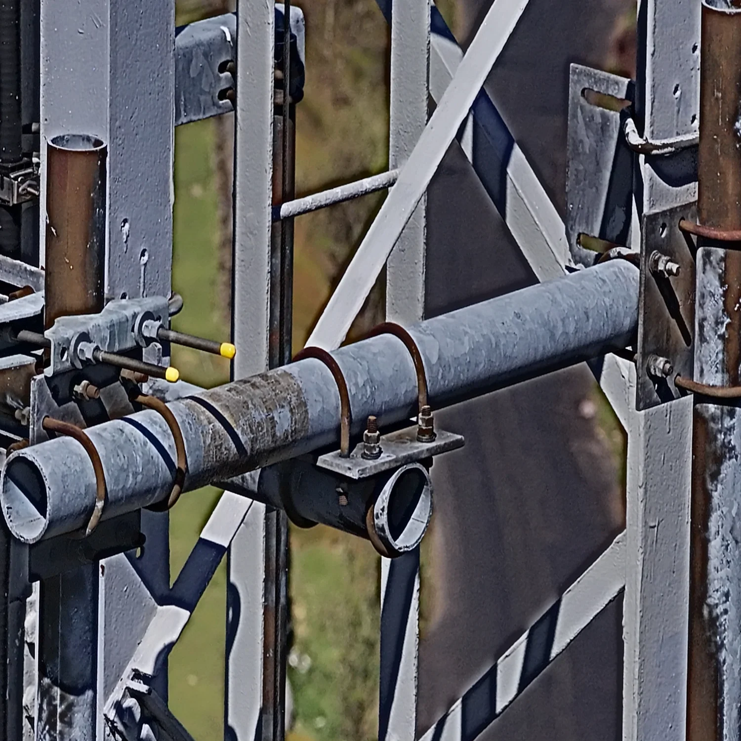
- **Superior Detection & Detail** — Capture minute structural issues/defects such as fine cracks, corrosion, delamination, spalling, moisture intrusion, and fatigue indicators with exceptional clarity — even in darkness or under bridges.
- **Actionable, Archivable Data for Long-Term Monitoring** — Generate high-quality, geotagged visual, thermal, and measurement datasets with **RTK-enabled centimeter-level positioning accuracy** (typically 1 cm horizontal + 1 ppm vertical in fixed RTK mode). Enable rapid creation of BIM models and digital twins via photogrammetry and integrated sensor fusion. Compare time-series data to identify degradation trends, predict potential failures, and shift to proactive, predictive maintenance strategies.
**Key Technical Capabilities of Our Inspection Platform**
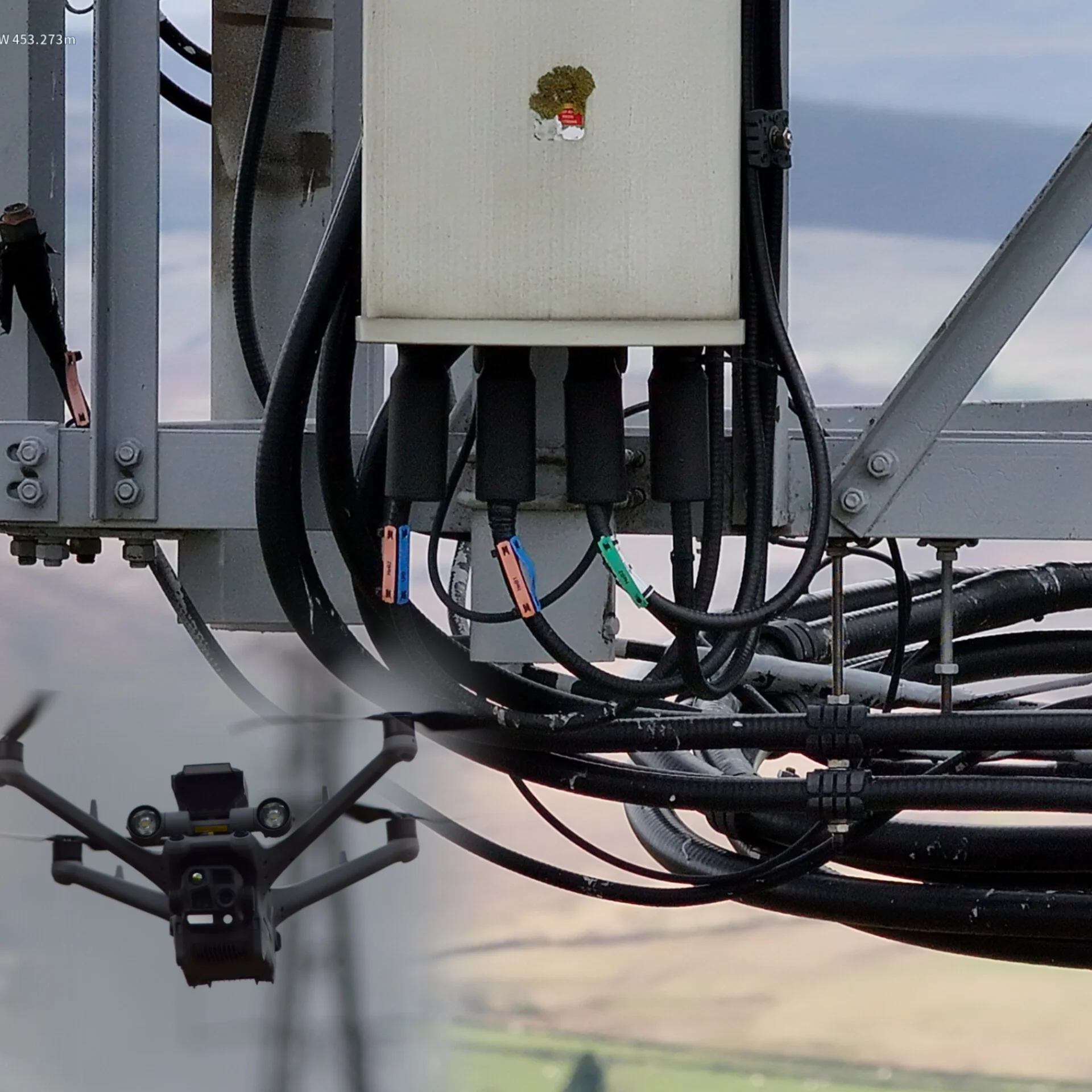
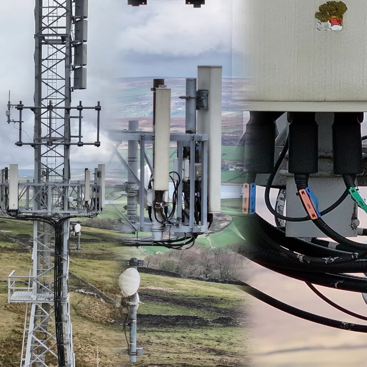
- **High-Resolution Imaging System** — Triple-camera array featuring wide-angle, medium-telephoto, and long-range telephoto lenses (all 48MP resolution on 1/1.3-inch or 1/1.5-inch CMOS sensors) for detailed close-up and distant views. Supports up to 80° upward tilt to capture undersides and hard-to-see bridge elements.
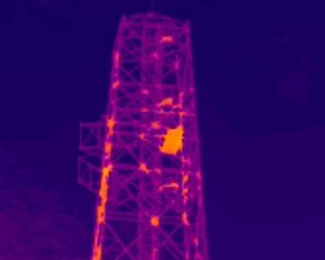
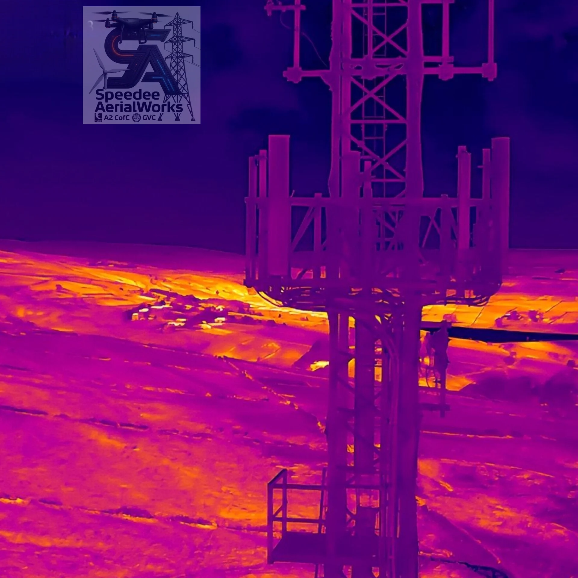
- **Advanced Thermal Imaging** — High-resolution infrared sensor with enhanced mode up to 1,280 × 1,024 resolution for detecting thermal anomalies like moisture pockets, delamination, or corrosion hotspots.
- **Powerful Integrated Spotlight Illumination** — 32 W spotlight with gimbal-follow tracking, always-on or strobe modes, and effective range up to 100 meters (covering 1,300–2,200 m²). Paired with built-in NIR auxiliary lighting, it provides crystal-clear visibility in total darkness, shadowed piers, under-bridge voids, or nighttime operations.
- **Precision Measurement & Positioning** — Built-in laser rangefinder (effective up to 1,800 m) for accurate distance, area, and volume calculations. **RTK GNSS positioning** delivers centimeter-level accuracy (±0.1 m hovering with RTK; RTK Fix: 1 cm + 1 ppm) for survey-grade repeatability, precise geotagging of images/thermal data, and reliable year-over-year comparisons.
- **Robust Environmental Performance** — Full IP55 dust and water resistance; operates reliably from –30 °C to 50 °C. Six-directional low-light fisheye vision sensors for obstacle avoidance in complex urban or structural environments.
- **Extended Flight & Intelligence** — Up to 54 minutes forward flight time (47 minutes hover); supports automated 3D mapping modes, real-time data streaming, and seamless integration with processing software for instant model reconstruction, point clouds, and digital twin generation.
This platform transforms bridge inspections from reactive, hazardous, and costly processes into efficient, safe, data-rich operations that deliver measurable value to engineers, maintainers, owners, auditors, and transportation authorities. With **RTK centimeter-level precision** ensuring consistent, high-accuracy data capture, we produce richer, more reliable insights — faster and safer — to extend asset life and prevent issues before they escalate.
Ready to experience next-level bridge inspection capabilities? Contact us for a demonstration of our advanced drone workflow, custom mission examples, or how we can support your next infrastructure project.
**Bridge Inspection Services | High-Res Multi-Sensor Drone | Thermal & Spotlight-Enhanced Imaging | RTK Centimeter-Level Precision | Digital Twins & Predictive Maintenance | Safer Infrastructure Assessments**